Thursday, April 18, 2013

Air Pressure and Climate


Tibet is a low pressure area. We learned that as you go higher in altitude, the lower the air pressure. Tibet is a higher area, meaning lower air pressure, and thin atmosphere, or less air.
http://home.arcor.de/pedalglobal/pix/himalayacycling/tibet99/af02.jpg 
Lets take a break shall we. The air is thin up hear. This is due to the thinner atmosphere in the higher altitudes.

Thermal Pressure is influenced by differences in temperature, warmer air is “lighter” than cooler air. One common occurrence in the Himalaya is what is called Diurnal Breezes. 
http://www.atmos.umd.edu/~meto200/3_18_03_lecture_files/slide0003_image067.jpg  
You can see in this diagram how the warm daytime air moves up the peaks, and the cool night air moves down the peaks.

When the land heats during the day, the air near the ground warms and rises, causing the air to move up the mountains, a breeze would blow towards the peak. At night, when the land cools, the air does as well, so it sinks to the ground. A breeze would be blowing from the peaks in this instance. 

Wind is controlled by what is called the pressure gradient.
http://www.physicalgeography.net/fundamentals/images/thermal2.GIF
You can see how the pressure changes as you move from the high pressure area to the low pressure area, air always moves in this direction.

In other words, the amount of pressure in one area and its change to another area. What we see is that air travels from areas of high pressure to areas of low pressure, creating winds. Tibet is typically its windiest in the winter, when it is in between the high pressure inland, and the low pressure out at the sea. The seaward winds are the Winter Monsoon. During the summer, it swaps, the land is a low pressure area, and so the winds blow from the sea. This is the summer monsoon.

Climate

Climate is basically defined as the longterm temperature, precipitation and seasonal pattern of an area. The Tibetan Plateau is considered a Highland Climate area. This is an area that is characterized by high altitudes, as well as mountains. Much of the precipitation of Tibet comes from run off from the glaciers and snow in the Himalayan Mountains. 
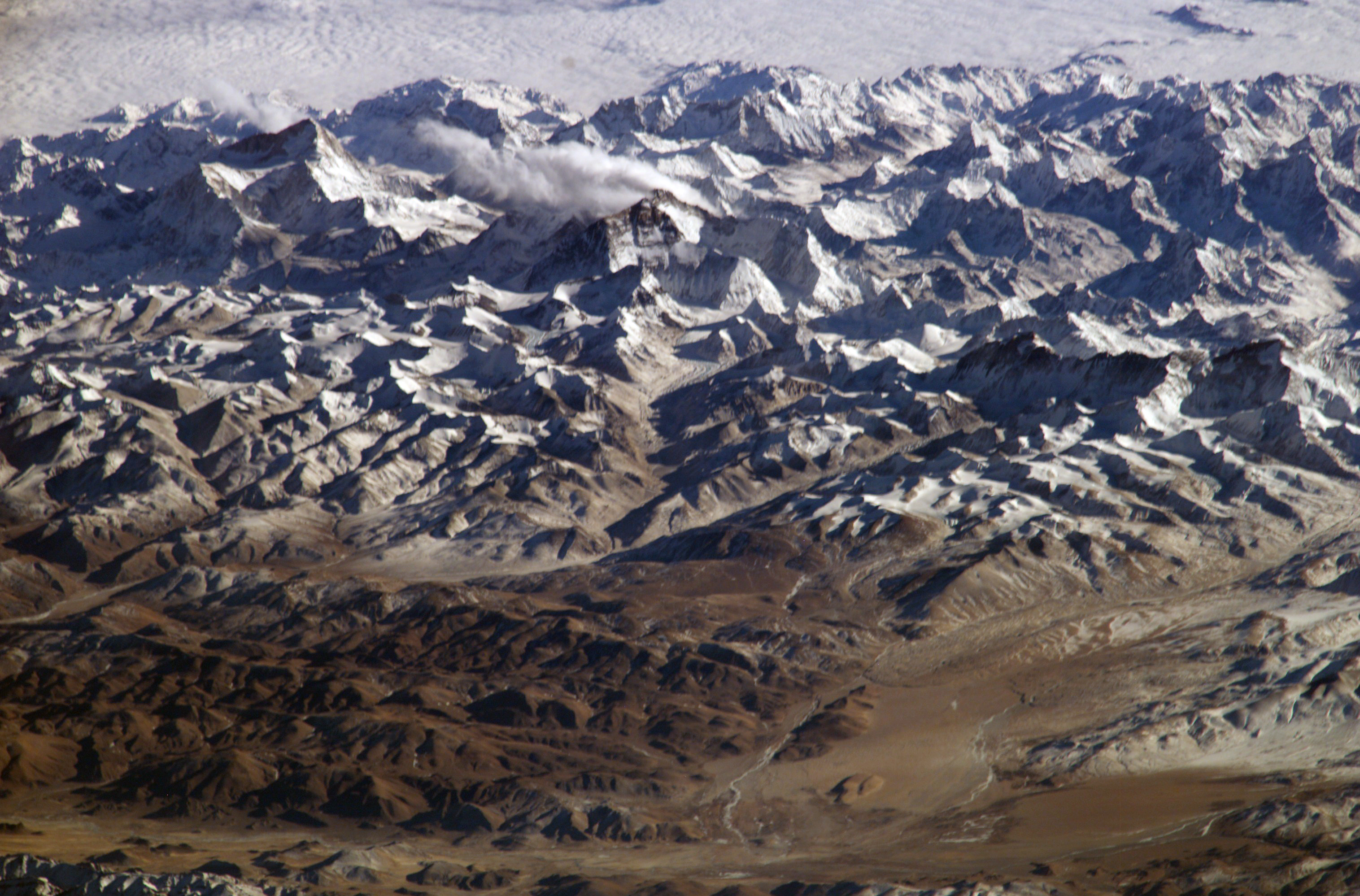
http://glacierchange.files.wordpress.com/2011/03/laigu-glacier.jpg 
You can see the glacier in this Google satellite image. During the warmer months the glacier will melt a little and the run- off will bring moisture to the soils below.

As stated before, a majority of the precipitation in Tibet comes from the summer monsoon, which bring wet sea air, and the higher temperatures melt the snow. Tibet has an extremely high soil moisture content. A prime location for farming or grazing.
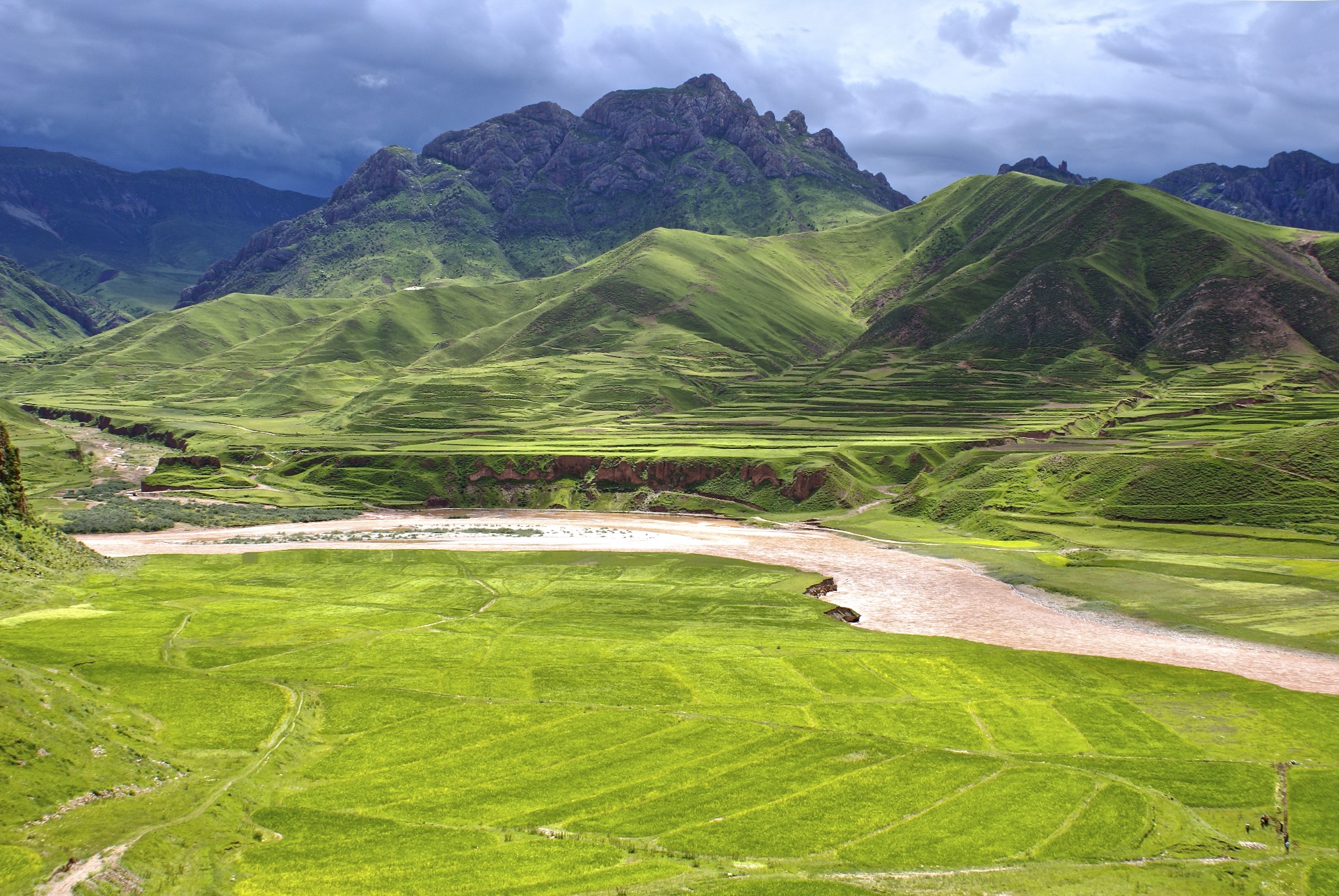
http://english.peopledaily.com.cn/200507/04/images/0702_B21.jpg 
The soil is very green during the summer. Run off from the mountains, and the coming of the Summer Monsoon bring extreme amounts of precipitation. Look at how wet the ground is!


Monday, March 11, 2013

Weathering


This post will mostly be about how rocks are weathered, breaking down in place, and erode, the movement of weathered rock sediments.

                                                                     Joints

Joints are fractures or cracks in rocks which allow weathering to occur more easily. (See picture below.)
You can see the columnar Joints in these rocks in a mountainside. These joints are prime locations for physical and chemical weathering to occur.


                                                          Physical Weathering

Physical weathering is the physical break down of a rock. One of the most common forms of physical weathering in the mountain regions of Tibet is Frost Wedging. (See Diagram below.)
http://mtweb.mtsu.edu/cribb/2.jpg 
You can see that the ice expands and pushes the rock further apart. This creates physical weathering, and is common in the colder Himalayan regions of Tibet.

This is caused by water moving into the joints of a rock and then freezing. As it freezes it expands, and when wedged inside a crack this causes pressure on the rock and widens the crack. Eventually, this will break off a weak section of the rock. 

A second form of physical weathering is Pressure Release. Much like the skin on our bodies, the rocks “exfoliate” which breaks off slabs of the rock. This happens when a rock is formed under pressure, and some form of quick erosion occurs and the pressure in the rock is released, and breaks off the rock slabs.

                                                         Chemical Weathering

Chemical weathering is where there is an alteration to the rock and its minerals as they are broken down. A very common form of chemical weathering in Tibet is Dissolution. This is where water dissolves the rock completely. (See picture below.)
To the left of this monastery, down in the slump of the ridge, there is a lot of smaller dirt and dust. This is a result of chemical weathering and dissolution. The rocks have been broken down into smaller granules by dissolving in water.


Some surfaces are better for change than others. Transport Limited landscapes are covered in vegetation, which limits the amount of material weathering and erosion of sediments that can occur. (See picture below.)
http://www.thelandofsnows.com/wp-content/uploads/2012/01/DSC041441.jpg
You can see in this image that there is a lot of vegetation. This makes it extremely hard for erosion to occur as the vegetation interrupts the sediment flow. 

Weathering- limited landscapes have very little vegetation, which limits the rate of rock decay. (See picture below.)
http://www.himalayatraveladventures.com/public/files/483/default/beautiful-tibet-pictures-08.jpg
Here you can see that there is not much vegetation, making this a weathering-limited landscape. There is a slower rate of rock decay which limits the amount of erosion that can occur. Most of the Tibetan mountain regions are of this landscape.

Sunday, February 17, 2013

Plate Tectonics and Rock Make Up


One of the most distinguishing features of Tibet obviously, are the Himalaya Mountains along its southern border. 

These feats of plate tectonics were the result of the Indo- Australian plate colliding with the Eurasian plate about seventy million years ago. (thinkquest.com Formation of the Himalayas) Before this time, there was a sea that occupied the area between the plates where the mountains are now located known as the Tethys. As the super continent Pangea began to break up, this ocean was filled with the sediments of rivers from the Indian and Eurasian landmasses. (thinkquest.com Formation of the Himalayas) The crust of the Indian Plate was being subducted underneath the Asian Plate, which pulled the Indian Plate towards the Asian, which caused a collision and thrust the Eurasian plate on top of the Indian Plate creating the Himalayas.


Mt. Everest, the tallest of the Himalaya, is made up of sedimentary rock, or a combination of the eroded rock from the Eurasian and Indian rivers long before, which adds to proof that it was once underwater as suggested above. It is possible also, to see the Strata, or layers of rock on Everest as well, which create lines across its face and are visual portrayals of the different time periods and sediment collection. Everest is different from much of the rest of the Himalaya, the primary make up of Tibet is Limestone and Sandstone, sedimentary rock, but the Himalaya are made up of gneiss and schist, metamorphic rock, which is due to the intense pressure and heat when the mountains were created. (Mountains of Tibet factsanddetails.com)
Not only did the collision of the two plates create the modern Himalaya, it also created what is now called the Tibetan Plateau. This is the largest and highest place in the world. (Geology/about.com The Tibetan Plateau) The Plateau is a mix of continental fragments, which would suggest that most of the rocks that can be found on and in the Plateau would be sedimentary. (Geology of the Tibetan Plateau http://oak.ucc.nau.edu